Harley
Owners Group #1665 / Antelope Valley CA Chapter / Ridgecrest Activity
Group
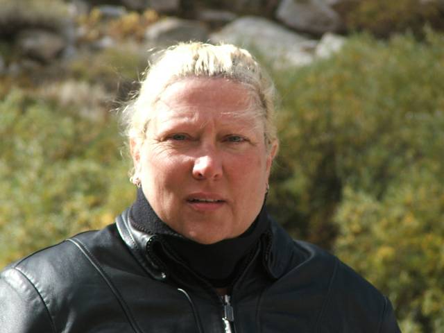
Debbie and Tracy's
Sonora Ride
Pictorial and Narrative
3 days, 900 miles
October 1, 2005
Posted:
1 November 2005, 9:30 PM
As
I said in my last posting of pictures from the trip to Canada that Debbie
and I took last summer we both work for NASA. There are a group of us
there that try to get together a couple of times a year and take a ride
somewhere for the day, nothing real fancy just a few friends getting together
to take a ride somewhere. Well when the unofficial planner of most of
these trips called a few weeks ago and asked if we wanted to take a ride
up to Bishop for the day we both checked our calendars and said we would
love to join them. Most of the riders live in Lancaster or Palmdale and
since we were heading north anyway it was easy to just meet them out at
the junction of Hwy 14 and Cal City Blvd then head from there. It started
out as a very nice fall day the 1st of Oct and the weather, although a
bit chilly that early in the morning promised a glorious day for a ride.
After everyone filled up on gas and caffeine at the gas station we mounted
up and headed out for what we hoped would be a trouble free ride.
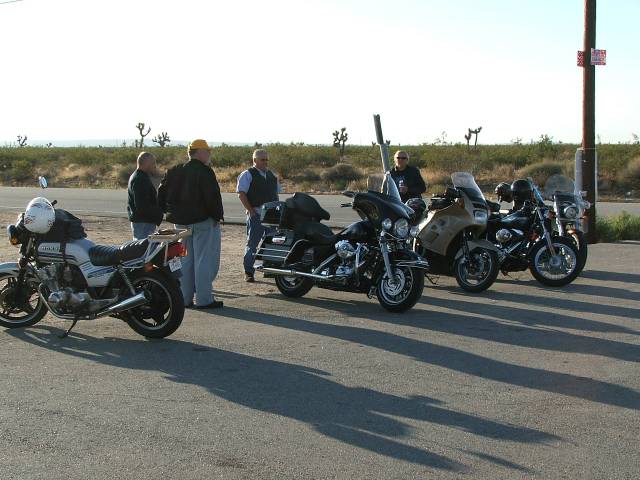
Meeting
in the morning for a ride with friends.
We
had met most of the people that were going to go with us at Cal City Blvd
but one of the riders lives in Victorville so the first stop we made was
at the gas station on 395 at Pearsonville to wait for him and his passenger
to show up. While there we again filled up on caffeine, strange how that
works sometimes huh.
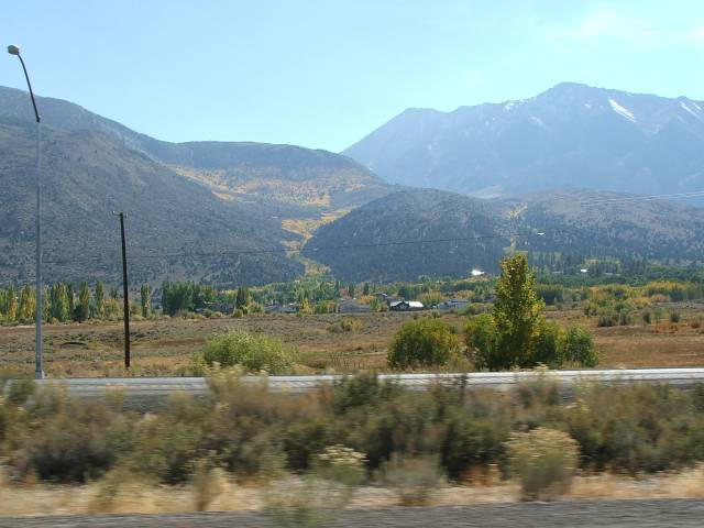
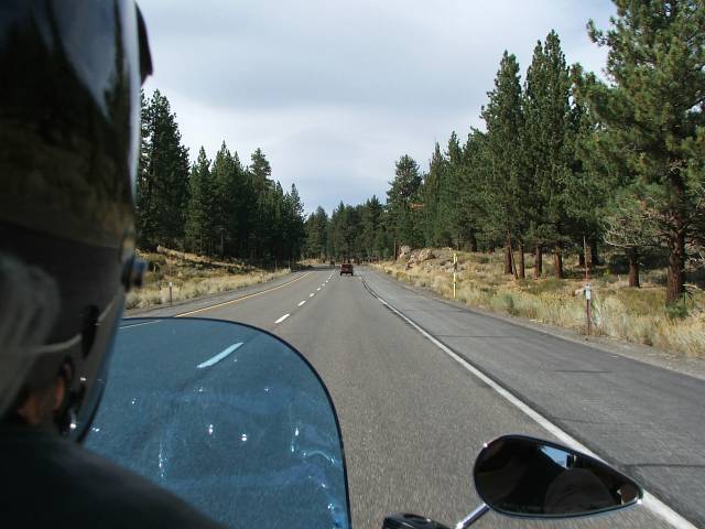
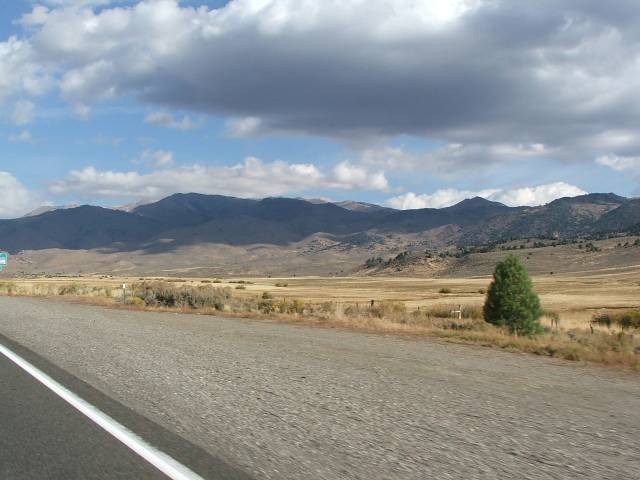
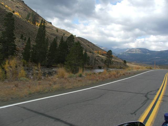
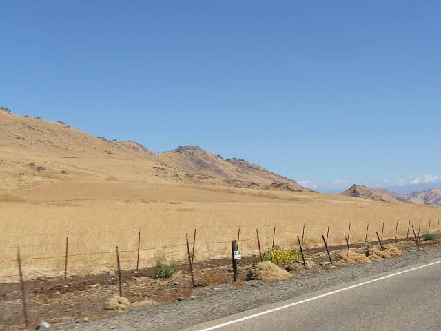
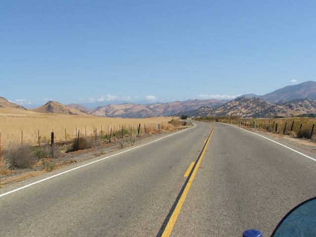
Once they had showed up and we were again astride our machines we headed up 395 in search of who knew what. The ride up the Owens valley was uneventful but still an enjoyable ride. We would have more pictures of the ride up, but both Debbie and I forgot to get the camera out when we stopped the first time, but that part of the ride really wasn’t the reason for this anyway, most of you have rode or drove up 395 to Bishop so I’m sure that its not anything new.
Once we had arrived in Bishop we had a small problem we had to deal with, one of the bikes died at a stoplight in Bishop, no warning or anything just up an died. We had planned on having lunch at Schats Bakkery so we managed to push his bike to the parking lot and decided to look into it after eating, had to recover from pushing his bike anyway, I’m not as young as I once was. Well it turned out that his battery was stone cold dead and the charging system wasn’t working up to par, we tried to jump his bike but the battery was in to bad a shape and he had to find a new one to get him home on. After a new battery was acquired and installed the general consensus was to go to the Indian casino and see how much money could be donated to the tribe.
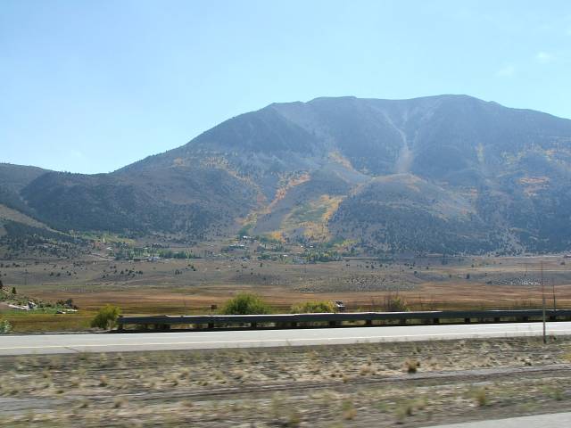
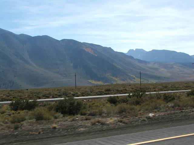
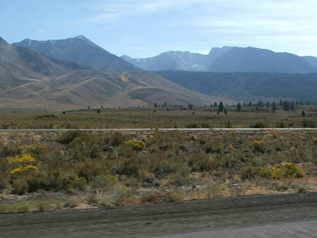
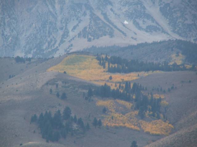
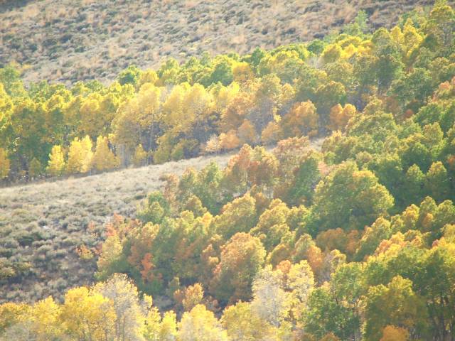
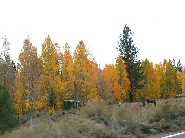
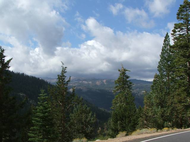
Now I have a problem in that once I’m out on the bike I just want to keep going and see whats over the next hill. With this in mind and knowing how I am I had made plans to continue our ride a couple of days. So after we got the battery replaced and the rest of the group going to the casino Debbie and I headed north up 395. We had planned to spend the night in Bridgeport and continue from there the next day. Bridgeport is a small town about 80 miles north of Bishop and the ride up 395 to it takes you through some breathtaking areas, but when you add to that the changing of the leaves with the onset of fall it takes on a totally new dimension. The trees were in the middle of changing so we got to see all shades of yellow, red, and orange with the green of the evergreens thrown in to for background. It’s a ride that I will be taking again in the future. I have been to New Hampshire and Vermont in the fall and seen the changing of the leaves there, but when you add the grandeur of the Sierra Mountains to the leaves it can’t be beat. There were places that the trees would grow in the valleys of the mountains and with the colors it looked like a river of fire coming down the mountain side.
Once they had showed up and we were again astride our machines we headed up 395 in search of who knew what. The ride up the Owens valley was uneventful but still an enjoyable ride. We would have more pictures of the ride up, but both Debbie and I forgot to get the camera out when we stopped the first time, but that part of the ride really wasn’t the reason for this anyway, most of you have rode or drove up 395 to Bishop so I’m sure that its not anything new.
Once we had arrived in Bishop we had a small problem we had to deal with, one of the bikes died at a stoplight in Bishop, no warning or anything just up an died. We had planned on having lunch at Schats Bakkery so we managed to push his bike to the parking lot and decided to look into it after eating, had to recover from pushing his bike anyway, I’m not as young as I once was. Well it turned out that his battery was stone cold dead and the charging system wasn’t working up to par, we tried to jump his bike but the battery was in to bad a shape and he had to find a new one to get him home on. After a new battery was acquired and installed the general consensus was to go to the Indian casino and see how much money could be donated to the tribe.
Now I have a problem in that once I’m out on the bike I just want to keep going and see whats over the next hill. With this in mind and knowing how I am I had made plans to continue our ride a couple of days. So after we got the battery replaced and the rest of the group going to the casino Debbie and I headed north up 395. We had planned to spend the night in Bridgeport and continue from there the next day. Bridgeport is a small town about 80 miles north of Bishop and the ride up 395 to it takes you through some breathtaking areas, but when you add to that the changing of the leaves with the onset of fall it takes on a totally new dimension. The trees were in the middle of changing so we got to see all shades of yellow, red, and orange with the green of the evergreens thrown in to for background. It’s a ride that I will be taking again in the future. I have been to New Hampshire and Vermont in the fall and seen the changing of the leaves there, but when you add the grandeur of the Sierra Mountains to the leaves it can’t be beat. There were places that the trees would grow in the valleys of the mountains and with the colors it looked like a river of fire coming down the mountain side.
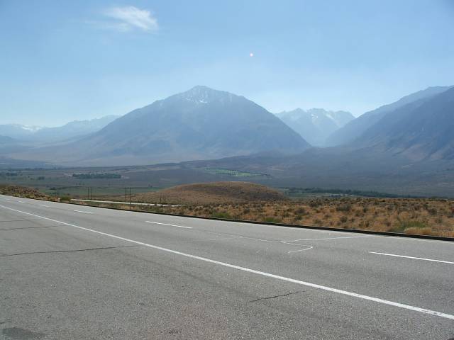
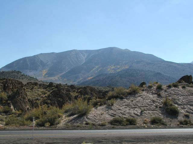
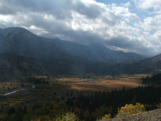
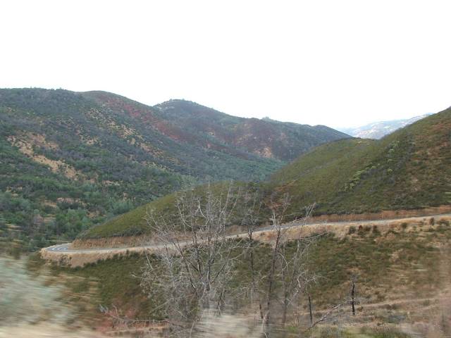
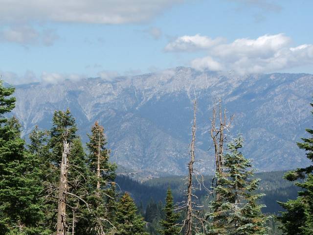
Looking
back at the Owens Valley from half way up Sherwin Grade.
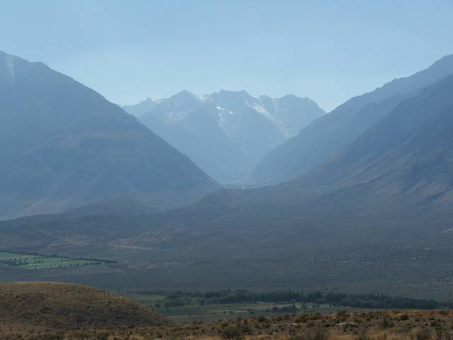
Looking
back at some of the Sierra Mountains from Sherwin Grade.
Some
of the trees starting to change colors going up Sherwin Grade.
More
color from the Trees.
Trees
looking like a river of fire coming down the mountain.
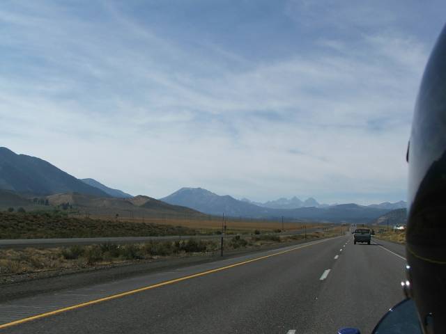
Hwy
395 heading north towards Crowley Lake.
Wonderful
color show nature puts on every year.
Another
river of fire, notice snow in back ground.
Looking
over Tracy’s shoulder climbing up to the June Lake area.
395
coming up to Mono Lake.
Splash
of color only nature could provide.
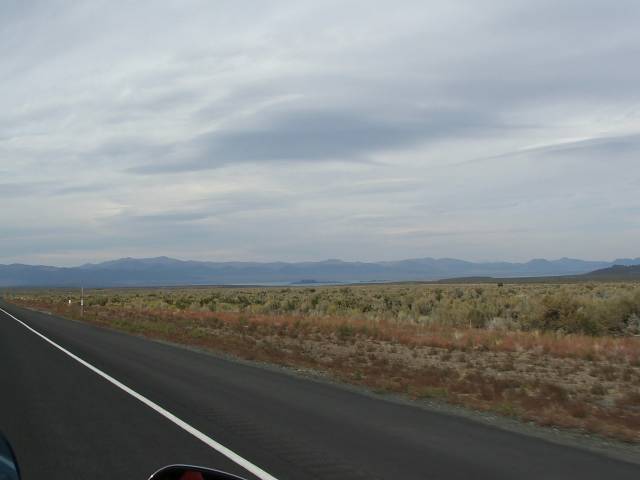
The
ride up to Bridgeport also takes you by Mono Lake; I had been past Mono
when almost all the water was being taken out of it to satisfy the needs
of Los Angles and was very happily surprised to see that the level has
gone up considerably since then. Sometimes it takes a law suit to make
people wake up and smell the Tufas. For those of you that don’t
know what a tufa tower is, this is the tower that sticks out of Mono and
several other lakes that is formed under the lakes surface by the chemical
reaction of calcium in fresh water springs, or for an easier explanation
it’s the white towers that stick out of Mono. I remember the towers
sticking out of the lake several feet but now you can only see a foot
or so sticking out on the 395 side. I think it’s cool that they
are bringing the level of Mono back up some.
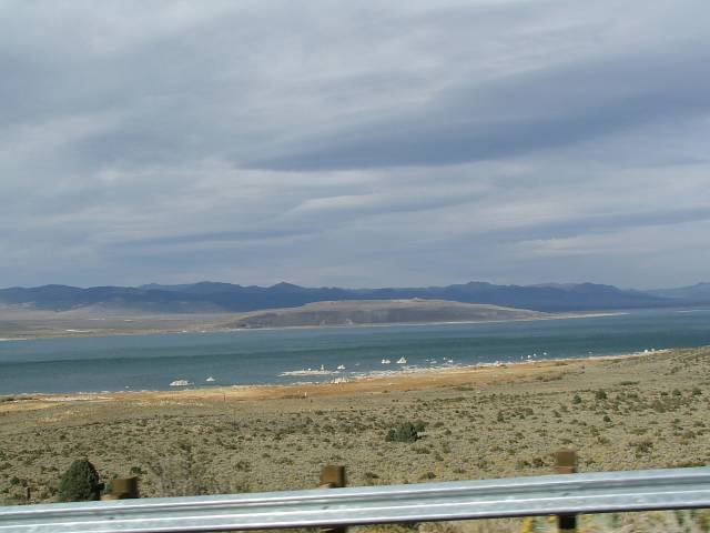
Mono
Lake, notice Tufa Towers.
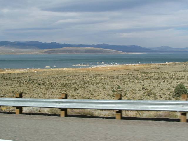
More
Tufa Towers, they aren’t as big as in the past.
After
a wonderfully colorful ride up from Bishop we arrived at Bridgeport. This
small town is right on 395 and has a very rich history, just in the town
itself there are eight historical markers or sites. And that’s not
even including the town of Bodie that is only a few miles away, albeit
a very rough few miles. One of the most prominent buildings as you drive
through Bridgeport is the courthouse. This building was built in 1880
and is used to this day as the county courthouse. They even have an old
brass cannon in the front of the building. On the same side of the street
as the courthouse is the place that we had dinner that night, a place
called Rhino’s bar and grill, they have great food, great atmosphere
and a really cool bar that runs almost the length of the building. The
next morning we walked around town a bit and then had breakfast at another
historic building, the Bridgeport Inn was built in 1877 as a stage stop
to and from Bodie. Its been turned into a hotel, Mark Twain is rumored
to have stayed here at one point. Bridgeport is a very cool little town
to explore and I’m sure that Debbie and I will be going back there
to spend some more time doing just that.
Like
a small lake of color from the trees.
Yellow,
green, red and orange show from Mother Nature.
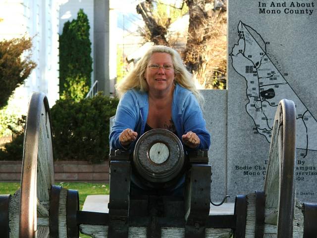
Debbie
over a barrel.
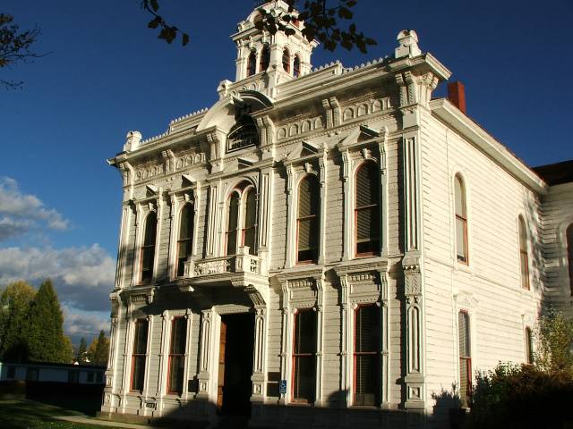
Mono
County Courthouse in Bridgeport.
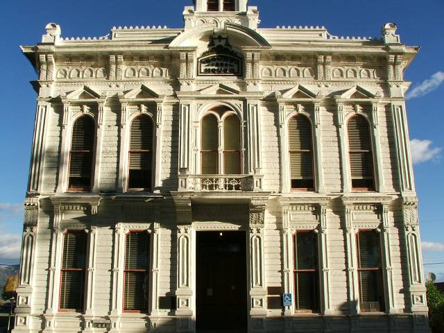
Used
as Mono County Courthouse since 1881.
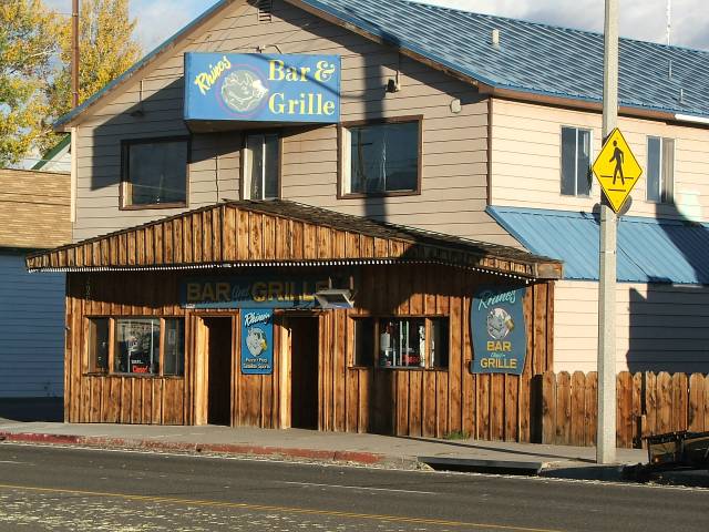
Rhino’s
Bar and Grill in Bridgeport, damn good food.
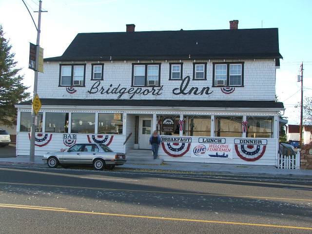
Historic
Bridgeport Inn built in 1877.
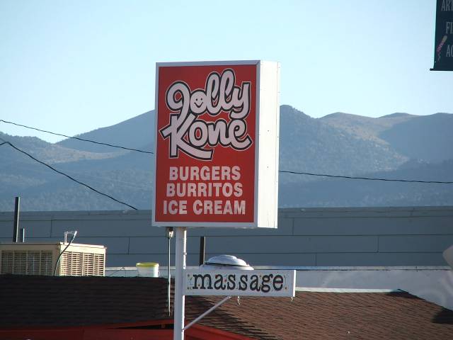
Had
to take this picture, “Burgers, Burritos, Ice Cream and Massage??”
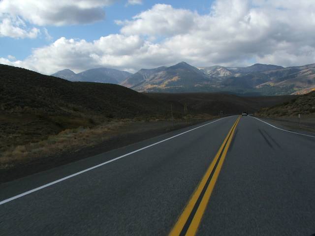
After
leaving Bridgeport the next morning we took the short 20 mile ride up
395 to the real reason for this ride. We had been over the Tioga pass
and while we were traveling down 395 this past summer we had seen the
other two passes over the Sierra’s the Monitor pass and the Sonora
pass. We had made the comment to each other that we would like to take
both of them at some point. Well since we were going to be in Bishop anyway
I figured it was only about 100 miles further up to the Sonora pass rode,
the 108 so why not make a weekend of it and get to see some of nature’s
palette of colors to boot since I knew that the leaves would be in full
change. And the weather wasn’t supposed to be that bad that weekend,
a bit of clouds and a bit chilly but that’s what leather is for
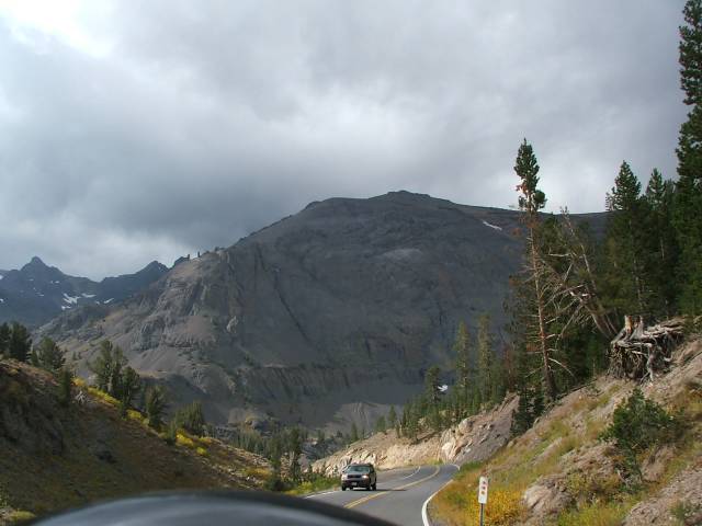
anyway. Right after you get off of 395 and onto the 108 there are two
signs, one warns that vehicles over 22 feet are not recommended and the
other lets you know that the grade going down the other side is 26%, yes
that’s right 26%. Now to give you a bit of reference the grade down
into Bakersfield from Tehachapi is 6% so you can get an idea of just how
steep the grade is. You had better make damn sure that your brakes are
in good shape if you are going to go down it as it would be real scary
to try and do it with bad brakes. It was a fun ride if not a bit freaky
to be going down such a steep grade but the scenery made up for it in
spades. There is no way that the pictures we took can do justice to what
Mother Nature did up and over the Sonora pass. There are vistas that simply
take your breath away and with the changing of the seasons the colors
that you see are fantastic. There seems to be no way it can get any better
then you come around the next corner and you find out that it can and
does get better. And the road is a blast on top of the view around you.
I highly recommend that if you ever get the chance to ride over the pass
in the fall that you take advantage of it, you won’t be disappointed.
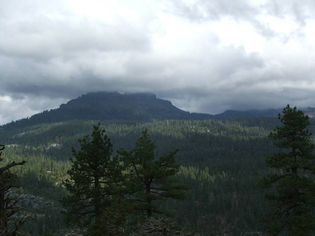
The summit of the Sonora pass is at 9624 feet above sea level and from
the 395 side you climb about 5000 feet in about 15 miles so it’s
a nice climb. As you traverse your way down the western side of the Sierras
you pass quite a few places that you can stop and take in the wonderful
views. One such place is called Donnels vista, we stopped at this vista
to see what it was and after a short hike off of the bike, maybe ½
a mile we were greeted by what has to be one of the most spectacular views
one can imagine. You are about 2500 feet above the Stanislaus River above
Donnels Reservoir; the short walk is well worth it to see the view from
up here.
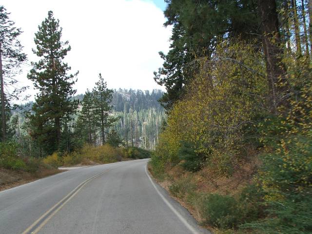
North
of Bridgeport heading into the Toiyabe National Forest.
Looking
north into the Sierras.
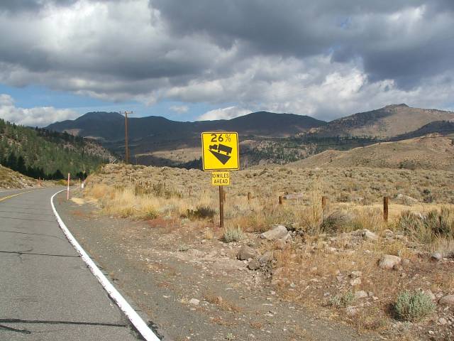
26%
grade on the down side of Sonora Pass, yes that’s right 26%.
One
of many small creeks and streams going up Sonora Pass.
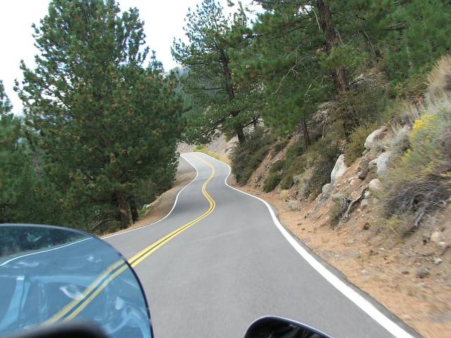
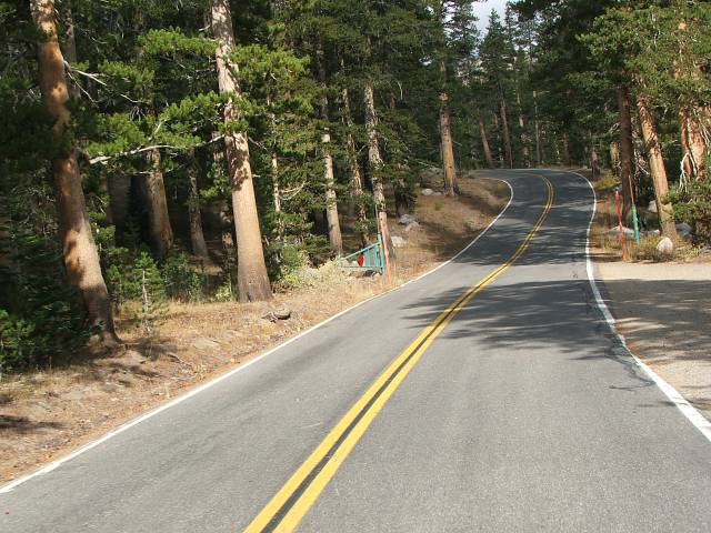
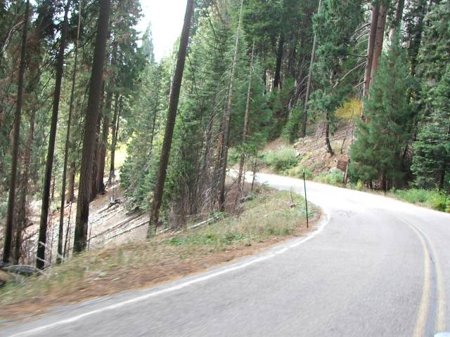
108
is a steep winding road the whole way up.
Just
a splash of the color going up.
Looking
out over a meadow while climbing Sonora Pass.
Gates
they close when the snow gets to bad to pass.
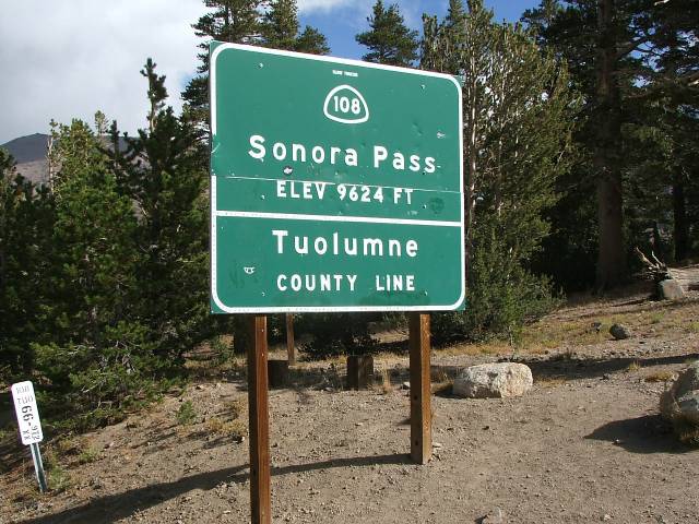
Sonora
Pass summit 9624 feet and worth ever foot.
Heading
down the other side, notice the trees in relation to the road.
Debbie
bundled up; it was cold way up there.
Looking
out over the Sierras, well worth the trip.
Clouds
covering the top of the mountain.

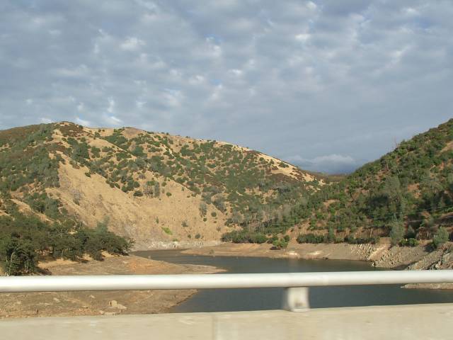
Donnell
Reservoir on the Stanislaus River.
After
we got down to the bottom of the Sonora pass we arrived in the town of
Jamestown, just a few miles from the town of Sonora. Jamestown is one
of the many former mining towns that dot the western side of the Sierra’s
in an area know as gold country as this is where there was lots of gold
taken out in the late 1800’s and early 1900’s. For the most
part the towns have either dried up or are just shells of what they were
during the gold rush. However some have taken advantage of the rich history
and used it to bring in tourist dollars. Jamestown is just such a town,
the downtown part of the town is much as it was during the towns heyday
with lots of little shops that are just waiting for you to spend your
money in them. Then there is what used to be the train station which has
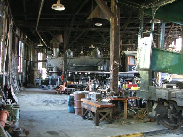
been taken over by the state and turned into a state park called Railtown
1897. They have several of the buildings still there and they run steam
trains out of town on the Sierra Railway. This railway and its building
have been used in many movies and television shows such as Petticoat Junction,
High noon and it was used in Back to the Future 3. They have many cool
things to see here and one could spend a day just poking around the many
buildings they have. The train station at Jamestown is at 1476 feet above
sea level so from the top of Sonora pass to Jamestown you drop almost
8150 feet so you can see its quite a ride down the pass.
Real
horsepower in Jamestown.
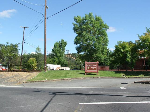
Entrance
to Railtown 1897 in Jamestown.
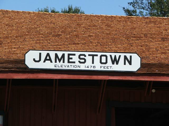
From
9624 feet at the summit to 1476 feet at Jamestown a drop of 8148 feet.
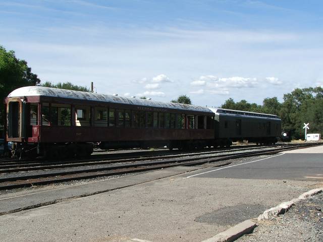
Old
passenger cars at Railtown.
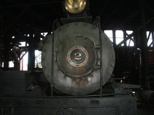
#2
engine, a 3 truck Shay from the Lima Locomotive works.
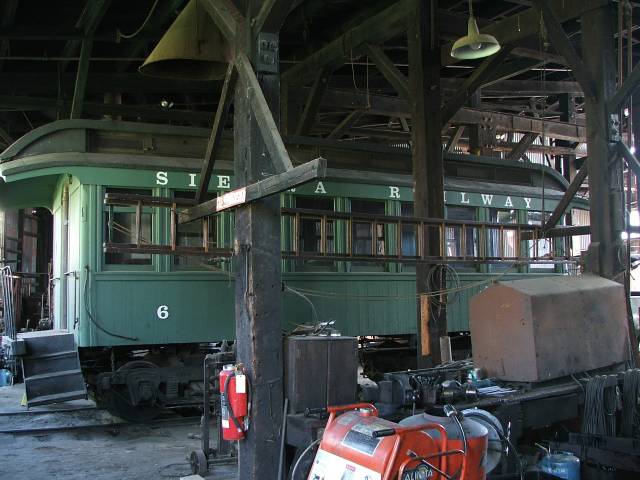
Sierra
Railway # 6 passenger car.
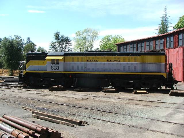
Sierra
Railway # 613 diesel engine, an Alco I believe.
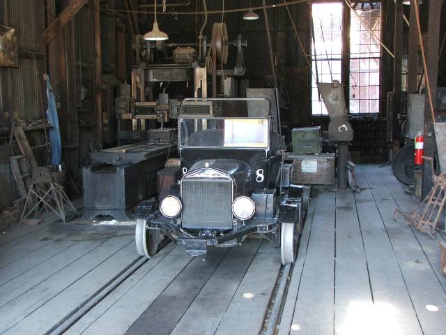
Ford
Model A track car.
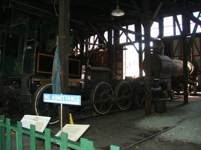
One
of the engines in the roundhouse getting worked on.
Sierra
Railway # 34, yeah I know I missed the 4.
After
we left Jamestown we continued down the 108 for a few miles, we had planned
to take Hwy 49 down to Oakhurst where we were going to spend the night
but after looking on the internet for things on 108 I saw that they had
some cool things just a few miles to the west of the turn off for the
49 on the 108 and since we had guaranteed reservations in Oakhurst we
figured why not, we were this close anyway. So after a short trip down
the 108 we arrived at the town of Knights Ferry. The town of Knights Ferry
is one of those places that you would never even think about stopping
at unless you had a reason to, there is nothing to it and you can’t
see much of the town from 108 anyway. However if you had done some research
which I like to do when I know we are going to be going some place new,
you would have found out that Knights Ferry is the site of California’s
longest ever covered bridge. The bridge that stands now was built in 1864
to replace the one that was washed away in a flood in 1862. The bridge
is 330 feet long over the Stanislaus River. It was used to get goods,
people and livestock over the river during the gold rush. The bridge was
a toll bridge when it was first made and replaced the ferry that William
Knight made to get over the river. A horse and rider could cross the bridge
for 50 cents, and you could walk across it for 25 cents. These days it
doesn’t cost you anything to go across it but you can’t drive
over it anymore, after all it is over 100 years old and you wouldn’t
want to have your car or bike go through it and into the river, but its
only a short walk from a parking lot down to the bridge and its really
cool to see it. Across the river is an old building that originally was
built as a mill but was then turned into a power plant. There is still
some of the old equipment there, my guess is it is too heavy to steal,
and it’s interesting to see how they made power back then. All in
all it was well worth the short trip down to the town of Knights Ferry
and if anyone is in that area I would recommend the trip to see it.
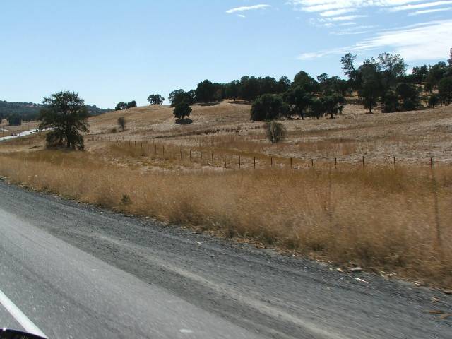
Rolling
hills of Gold country heading out of Jamestown.
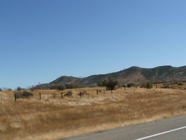
More
of the rolling hills.
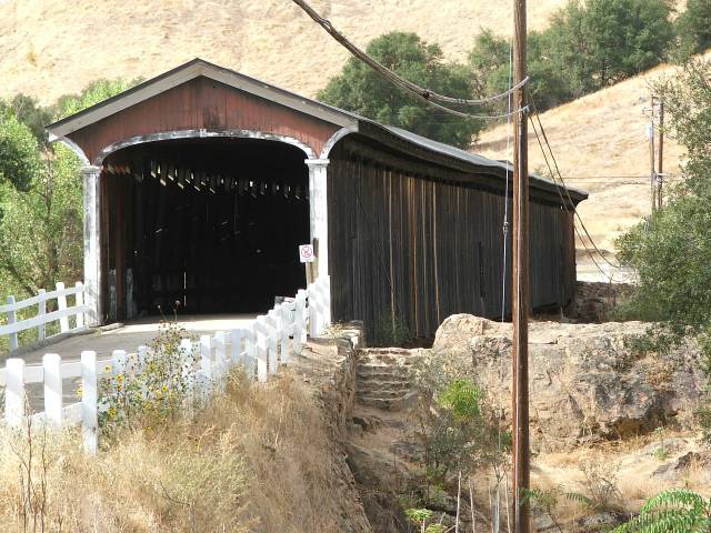
Covered
Bridge at Knights Ferry.
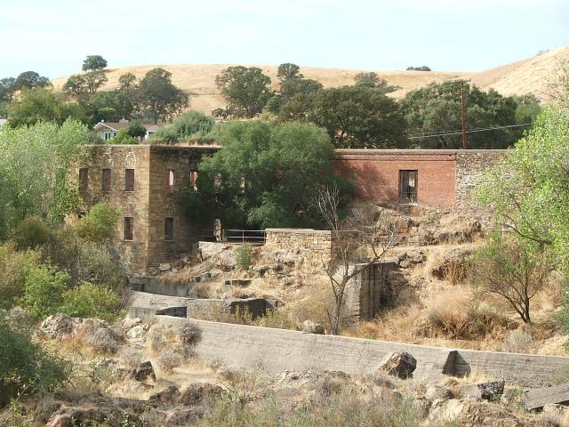
Old
power plant at Knights Ferry.
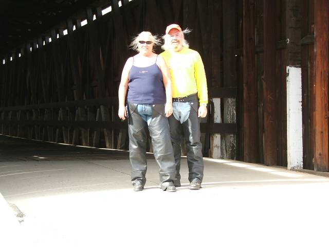
Us
at the covered bridge.
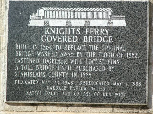
Sign
at the covered bridge.
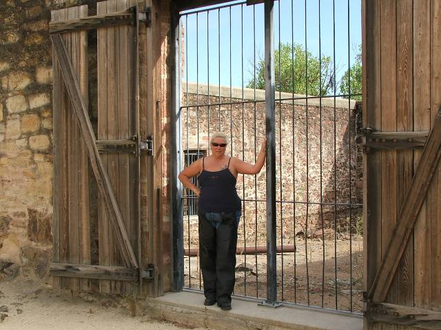
Debbie
at the power plant.
Tracy
same pose.
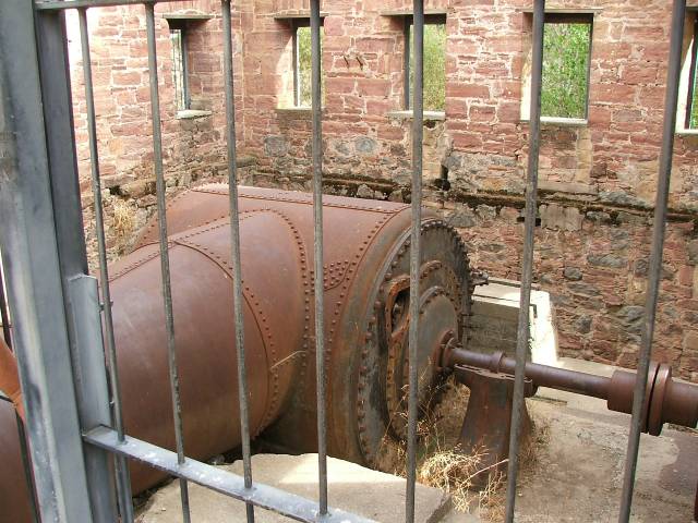
Contraption
used to turn the generator, water entered from pipe.
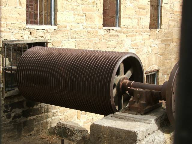
Part
of the generator that the water turned.
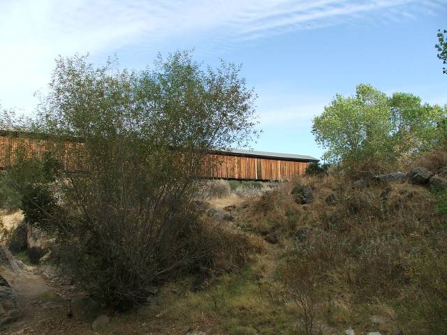
Covered
bridge from the power plant.
After
we left the town of Knight Ferry we went back up the 108 to the turn off
for Hwy 49, this road was the main route back in the gold rush for the
miners and others less savory types to get from one town to another. There
are lots and lots of little towns on this road and I can just imagine
that there were lots of others that have long since died and left only
a fleeting memory of their ever being there. When one is traveling down
this road its interesting to think of the many other travelers that have
been down this road and the treasures they carried with them. The road
itself isn’t all that interesting of a road from the 108 until you
get to the town of Coulterville, its just a meandering country road through
golden hills with a small town thrown in every so often to slow you down
a bit, there are some interesting building to look at in some of these
towns but for the most part it’s a pretty boring ride. Then after
you get to Coulterville the road starts getting interesting, all the way
to Oakhurst it’s a winding two lane road that give you lots of opportunity
to have fun leaning into the turns. Plus you get to see rivers and streams
aplenty. This is one of the fun roads to take a bike down and one that
if you get the chance is a whole lot more fun then going down the 99,
which is the other main road down the valley, even though the 99 is a
few miles west.
Heading
down Hwy 49 in gold country.
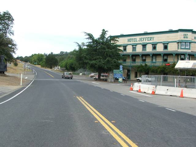
Hotel
Jeffery in Coulterville on Hwy 49.
Some
of the hills going down 49.
Merced
River under the 49.
Even
the grass is golden colored.
Hwy
49 heading towards Oakhurst.
We
had a wonderful evening in Oakhurst, the town of Oakhurst sits on the
most popular route into and out of Yosemite so it sees its fair share
of people through out the year. We had stayed in Oakhurst last year when
we went to Yosemite with Dennis and Debbie so we were already familiar
with the town a bit and stayed at the same hotel we had stayed at last
year. We even ate dinner at the same place as we did last year, a wonderful
little Italian place with really good food. We had gotten in rather late
so after dinner we hit the sheet with anticipation of another good day
of riding ahead of us.
Hwy
180 heading up to Kings Canyon.
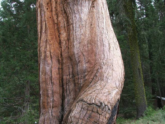
Giant
Sequoia tree base.
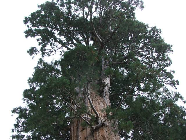
Same
tree but the top of it.
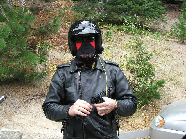
Yes
that is Tracy under all those layers.
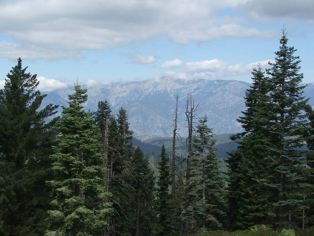
Lookout
in Kings Canyon looking towards Mt. Silliman.
Nature
makes the best views.
Sierra
Mountains from the Sequoia Park.
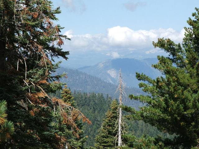
The
next day dawned a bit on the chilly side but sunny and promising a rather
good day of riding. We had planned to go down the 41 out of Oakhurst to
Fresno then take the 180 east into Kings Canyon National Park and The
Sequoia National Park, these two parks though founded at different times
share boundaries and are sometimes considered the same place but in reality
they are very different places, we had hoped to go through them both and
come out the other side above Porterville but as we all know the best
laid plans of mice and men don’t always work out the way we want.
We had gotten about 40 or so miles into the parks when both Debbie and
I had about enough. Being as though we were up at about 8000 feet or so
and the wind was blowing it was getting rather cold, now in most cases
that’s ok, after all we had been at over 9500 going over Sonora
pass. This was a bit different though, the way that these parks are situated
on the western slope of the Sierras they have a tendency to make their
own weather. The warm air from the valley floor is pushed up the slopes
and meets with the cold air off of the mountains and makes clouds, these
clouds were forming rather rapidly that day and combined with the cold
air it felt and looked like at the very least rain and possibly even a
bit of snow. I have ridden in the snow before, I lived in Tulsa while
I was going to school so I have done it, however its not one of the things
that’s high on my list of fun things to do so discretion being the
better part of valor we decided to go back out the way we came in and
find another way down to the valley floor. A couple of miles outside of
the park entrance we came upon a sign that said Porterville 42 miles.
We have a set of maps that we carry in the bike so we parked and looked
at the map to see if that road did go where we wanted and it looked like
it did and was a fairly nice road, well we soon learned that they don’t
show everything on those maps. This road, the 245, while only 42 miles
took us over 2 ½ hours to get down it was windy and narrow but
a really fun road nevertheless. And we saw lots of wildlife while we were
on it, we only got pictures of the deer but we also saw wild boar, quail,
lots of squirrels and other assorted creatures. But the part I think I
will remember the most was the shacks and camps that are on this road,
one only needed to see Ned Beatty on the porch of one of these shacks
playing a banjo to complete the scene. This is a place truly untouched
by modern life.
Hwy
245 out of Kings Canyon going towards Porterville.
Hwy
245 is a very winding road.
Mule
deer along 245.
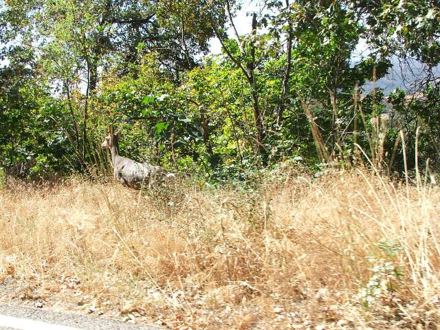
Not
sure if we scared him or he scared us.
After
we finally got down to Porterville we found a little Mexican restaurant
in downtown and had a good meal of home cooked food that really hit the
spot. The only problem with eating like that was that we still had a couple
of hours of riding left to get home, but since it was on Hwy 65 and not
on the 99 it wasn’t bad and we could take our time so as to not
shake up our dinner to bad, we got home that evening around 7 pm happy
if not a bit weary from a nice 3 day round trip of almost 900 miles. The
only real problem with our ride is now I have to have another 5000 mile
service done on the bike. We had one done just before we left on our trip
up to Canada this year in July so that makes 2 in just over 3 months.
But at least we are enjoying our bike and isn’t that what it’s
all about…………